Staff, Technology & Capabilities:
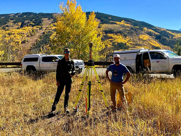
Boulder Land Consultants’s staff includes two full time field crews headed by party chiefs with over 45 years of combined field experience. In addition to topographic and boundary surveying experience, our field staff has considerable expertise in all types of construction surveying, capable of resolving problems on site as they arise.
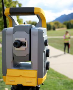
Our field equipment includes state-of-the-art total stations (robotic and conventional) and GPS equipment outfitted with data collection computers, which transfer field data directly to our office computer system. Our firm employs a Windows PC-based computer network to provide our clients with the convenience of digital technology. Currently operating in an AutoCAD 2019 / Civil 3-D / Carlson environment, we can provide 3-D coordinate project data, maps and drawings to our clients in a variety of digital formats.
Boulder Land Consultants also utilizes the Internet and E-mail to enhance client communication, and as a delivery tool for digital mapping products. Our e-mail address is info@blcsurveyors.com.
Special Technology Services:
Many of our larger projects require aerial mapping services. Boulder Land Consultants in conjunction with Landmark Mapping, Ltd of Pueblo West, CO and FlyNorth of Niwot, CO, can provide clients with rectified photographic images as well as digitally based topographic and orthometric mapping. These products can be provided via conventional aerial photogrammetry or via UAV (drone) technology.
Many of our land surveying projects benefit from global positioning technology (GPS). Far flung control points not readily accessible or intervisible using conventional techniques can be established to a high degree of accuracy. This technology can help to create large control point networks, which can be developed and adjusted comprehensively. Additionally we can provide GPS-RTK/VRS surveying services for data point densification, be it for construction layout, utility structure location, or topographic mapping enhancement. Boulder Land Consultants deploys Trimble VRS receivers and Trimble software/firmware, in supplying clients with GPS services and reports.
Certifications:
- CDOT Disadvantaged Business Enterprise (DBE)
Licensed Professional Land Surveyors in Colorado, Wyoming and North Carolina:
- Kayce D. W. Keane, PLS: CO PLS.0038197, NC L-4666, WY LS 13402
- Jason Emery, PLS: PLS.0020134
- Terry Pickering, PLS: Land Surveyor 38369
- Brian Hayhurst: LSI 60625