Frequently Asked Questions

FAQ

Per Colorado Revised Statutes 12-25-202(7): "Professional Land Surveyor" means an individual who practices professional land surveying and who is currently licensed with the State board after demonstrating competency to practice, as defined by section 12-25-214. Licensing is earned through years of education and experience and successful completion of a series of licensing examinations.
A land survey is performed for the purpose of locating, describing, monumenting and mapping the boundaries and corners of a parcel of land. It may also include mapping of the topography of the parcel, and the location of buildings or other improvements upon the parcel.
A boundary is any natural or artificial separation marking the border of two adjacent properties. A natural boundary is one existing in nature such as a river, while an artificial boundary is one created by written conveyance such as the Public Land Survey System, Subdivisions or Deeds.
Most boundaries are created by written documents (such as Warranty or Quit Claim Deeds) that contain specific descriptions. Property rights may also be established by unwritten means such as long time physical occupation of land. A Professional Land Surveyor will research these factors and how they affect the boundaries of your property.p
You should have your land surveyed:
  • Before you purchase it. This will disclose the relationship between the lines of possession and the deeded property lines.
  • A lending institution may require either a Land Survey Plat or an Improvement Location Certificate of your property when you borrow money on it.
  • Whenever you believe there may be a conflict of use on your property. Prior to dividing a parcel of land for sale.
  • The county or city where the property is located may require a Land Survey prior to the construction of any structure or improvements (such as fences) on the property.
  • When you intend to sell any tract of land.
  • When your attorney, architect, real estate broker or municipal planning or engineering office advise or requires it.
Explain why you want the survey. The surveyor can then advise you as to what standard and type of survey is required. You should furnish the Professional Land Surveyor with a description of the property along with all other information or documents that you have regarding the parcel. These would include abstracts of title, title reports, previous survey reports and maps and the location of any corner monuments. The Professional Land Surveyor may request a retainer and written authorization to proceed prior to conducting the survey.
The Professional Land Surveyor's fees will be based on the anticipated difficulty and time required to complete the project. Routine survey projects may be estimated as to cost, but the client should be aware that in many situations, the Professional Land Surveyor cannot predict the amount of work that will be required to recover necessary monuments, restore lost or obliterated corners, research city and county records, collect field data, complete mathematical calculations, and prepare descriptions and maps of the property. All of this must be combined and analyzed to establish the location of property corners and create the final map. One of the most uncertain and costly parts of the survey is the recovery of various types of monuments. It is important for landowners, contractors and the general public to be aware that the careless treatment and destruction of survey monuments adds time and cost to subsequent surveys. Competitive bidding for the lowest price does not necessarily protect the interests of the client, the public, or the Professional Land Surveyor. The competency, reputation, education and experience of several surveyors should be considered before one is selected to perform the survey.
A Professional Land Surveyor renders a highly technical service to the client. As a licensed professional, the services provided by the surveyor must comply with several applicable laws, regulations, standards and codes which have been established by state, county and local governments and professional societies. The Professional Land Surveyor must conform to these guidelines and abide by these high standards of conduct and practice.
The Professional Land Surveyor can:
  • Review your deed along with other evidence and render a professional opinion as to the locations and any conflicts of the boundaries of your land.
  • Set monuments at your property corners and mark them so they can be easily found and identified. Keep an accurate record of all services performed and measurements obtained.
  • Identify and advise you of any apparent defect in your land description or evidence of conflict of ownership and/or use.
  • Prepare a plat or map of your property indicating boundary measurements, the monuments found and placed, and the calculated area.
  • Provide the client with copies of these maps bearing the Professional Land Surveyor's signature and seal. Copies of these maps will also be filed in the County Records where the land is located. This will ensure that the plat or map is available for public inspection.
In addition, a Professional Land Surveyor is qualified to:
  • Create a property description for all new parcels or any existing parcels that may have a defect.
  • Appear in court as an expert witness concerning real property ownership, location or use.
  • Assist you in the planning and layout of the Lots, Blocks, Streets, Easements, etc. in a new subdivision.
Protect your investment: In order to protect your investment, it is best to retain a Professional Land Surveyor prior to the planning of your development and investment of funds. The Professional Land Surveyor can locate the boundaries of a property upon which improvements are planned and constructed and can layout proposed improvements on your property. These professional services assure that your improvements are positioned correctly, possibly preventing costly complications.

Did You Know?

Surveying is an ancient profession. It is quite probable that surveying had its origin in ancient Egypt. The Great Pyramid of Khufu at Giza was built about 2700 BCE, 755 feet (230 metres) long and 481 feet (147 metres) high. Its nearly perfect squareness and north–south orientation affirm the ancient Egyptians’ command of surveying. – source

Pyramid-Photo

Did You Know?

The Mason Dixon Line is actually a survey line. Charles Mason, an assistant astronomer at Greenwich Observatory, and Jeremiah Dixon, an astronomer, mathematician and surveyor, were hired to survey an agreed-upon line to settle a dispute between Pennsylvania and Maryland. It took 4 years and cost $75,000 to run the 233 mile line. Modern surveys have shown it to be an accurate survey, within a couple of seconds of latitude. – source
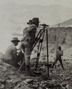
BLC-Lincoln-Surveyor